
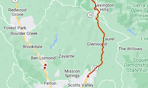
Several Bay Area roads were closed Friday morning because of weather-related hazards: snow and ice, flooding, downed trees.
The map above shows the location of some of the closures.
For more information and updates about state highways, see CalTrans’ QuickMap online, use the CalTrans app or call 800-427-7623. Google’s traffic map also notes some closures.
Among the closures Friday:
Highway 17 between Bear Creek and Granite Creek roads, snow and ice Highway 9 near Ben Lomond, road obstruction Mount Hamilton Road, snow and ice Page Mill Road near Foothills Nature Preserve, snow and ice El Camino Real underpass at University Avenue, Palo Alto, 4 lanes closed by