
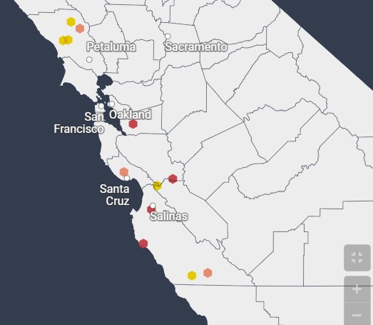
As residents along river banks brace for a new atmospheric river, forecasts show at least four rivers could reach moderate flood stage within the next three days.
Alameda Creek at Niles, the Salinas River at Spreckels, the Big Sur River near Big Sur, and the Pacheco Creek at Dunneville are all at risk of some flooding early this week, with a new storm expected to roll in overnight into Tuesday. But most of the Bay Area’s major waterways, including the San Lorenzo River in Santa Cruz, are not expected to spill their banks.
The new storm comes just a few days after a 74-year-old levee breached along the Pajaro